Weapons to respond to natural disasters and disasters
The United Nations (UN) warns that more than 1 billion people in coastal areas will face the risk of flooding by mid-century, nearly 50% of the world’s population in “danger zone” because of climate change if heat Global temperature increased by 1.5 degrees Celsius compared to pre-industrial times. Climate change has broken the rules, making it difficult to forecast the hydrology.

With the theme of this year’s World Meteorological Day (March 23) being “Early warning for early action”, the World Meteorological Organization (WMO) wants to highlight the importance of deploying warning systems. Early warning is an effective weapon to help countries respond promptly to disasters and reduce disaster risks.
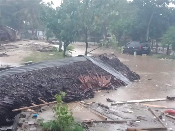
Experiencing many natural disasters and disasters, many countries have gradually become aware of the important role of early warning systems, especially after the Indian Ocean earthquake and tsunami disaster in December 2004, when an earthquake and tsunami occurred. A 9.1-magnitude earthquake struck off the coast of Indonesia, creating a tsunami as high as 17.4 meters that devastated Aceh province in the northern island of Sumatra, leaving dozens of villages wiped out. The tsunami then swept the entire coast of the Bay of Bengal, ravaging the coasts of Thailand, Myanmar, Sri Lanka, and India, killing more than 230,000 people in 14 countries. This is considered one of the worst natural disasters recorded in modern history. Many analysts believe that the consequences would not have been so dire if there was an early warning system to help people understand the situation and quickly evacuate to a safe place.
Just a few weeks after the disaster, the Intergovernmental Oceanographic Commission (IOC) of the United Nations Educational, Scientific and Cultural Organization (UNESCO) established the Intergovernmental Coordination Group (ICG) with the participation of 28 countries, are responsible for operating and establishing the Indian Ocean Tsunami Warning and Mitigation System (IOTWMS), with a similar operating mechanism to the system that has been operating in the Pacific Ocean since 1965. In addition, there are two more warning systems in the Mediterranean and the Caribbean to ensure all seas are safely monitored. Many countries in the region such as Sri Lanka, Indonesia, and Thailand have gradually improved their national warning systems and set up evacuation centers in case of disasters.
After many years of development cooperation, IOTWMS officially came into operation in 2011 and fully operated in March 2013. The system includes 101 sea level gauges, 148 seismometers and nine buoys, connected to satellites, and can send alarms to three regional Tsunami Warning Centers (TPS) in Australia and India. and Indonesia, thereby conveying the warning message to the countries concerned in less than 10 minutes. Over time, post-tsunami investigations have improved scientists’ understanding of the phenomenon, thereby improving system performance.
Scientists can now predict the frequency of tsunamis and how they will travel to shore. To ensure connectivity, the IOTWMS system is also regularly checked for communication networks, connecting information from TSP to national tsunami warning centers via email, SMS and fax twice a year. Through rapid information forwarding and effective emergency warning procedures, the IOTWMS system has significantly reduced tsunami damage, making the Indian Ocean region safer.
Compared to many regions, IOTWMS is still at the forefront of issuing tsunami warnings. Because a disaster can happen at any time, the system must always maintain operation, strengthen monitoring, detect threats from all sources, provide timely warnings. However, maintaining 24/7 operation is really a big challenge when the budget is decreasing. In addition to large sources of support from Australia, India and Indonesia when the system was first established, the direct contribution budget from the countries concerned has decreased from 9 million USD in 2005-2006 to less than 1 million USD. million USD in 2013-2014, while the annual cost of operating the system is about 50-100 million USD.
Although the Indian Ocean countries are better prepared to respond to disasters, the system can work well at the national and regional levels, but the IOC member countries believe that it is still necessary to ensure the system is able to function properly. can transmit information to people in remote areas. This task requires the great contribution of the media, helping to convey the correct message to the people. Besides, this warning mechanism is only really useful when people know how to handle the situation. Therefore, communities living in coastal areas also need to raise awareness of disaster risks, regularly conduct drills, and be ready to respond in case of emergency. Since 2009, IOWave tsunami disaster response exercises have taken place every 2 years with the participation of many countries in the region. While warnings can be issued within minutes, people need to be aware of the most obvious natural signs of a tsunami, such as earthquakes or rapid seas, in order to immediately evacuate to upland areas.
On a global scale, most countries still lack data on water depth and topography to complete a detailed study of flood risk, thereby providing emergency response and planning. evacuation plan when necessary. Although there is a large amount of seismic and sea level data to help detect tsunamis, there are still a number of gaps that make the data sometimes not available to warning centers, maintaining communication. Observational data between neighboring countries in the region remains a challenge.
According to former UNESCO Director-General Kochiro Matsuura, this system will not be effective without coordination among countries to exchange data openly and to operate all national warning systems together. family. In the next 5-10 years, the IOTWMS system still needs to continue to improve its forecasting model and upgrade technologies such as Global Positioning Satellite System (GNSS) and high-frequency radar to help warn of tsunamis more effectively. more fruitful.
Another limitation is that the system has difficulty predicting the scale of disasters accurately for residents living in high-risk areas such as hot spots of geological activity, or intersections of tectonic plate. Both the 2004 Indian Ocean tsunami and the 2011 Japanese tsunami occurred near the “Ring of Fire”. To be able to predict accurately, experts say that it is necessary to look at geological evidence in sediments and coral reefs to establish the timelines of past tsunamis, from which predict which areas are most likely to hit a tsunami and the scale of the disaster. If such a high-risk map could be mapped, governments would be able to focus resources on vulnerable areas.
In the 2011 earthquake and tsunami disaster that killed more than 15,000 people, Japan issued a tsunami warning within 3 minutes, but due to a lack of historical data, the authorities lowered the scale. The scale of earthquakes as well as tsunamis, when forecasting a tsunami is only 3-6 m high, while the actual number must be 2-3 times higher. Therefore, in addition to perfecting the warning system with advanced sensors and measurement equipment to warn within 3 minutes from the onset of the tsunami, Japan also prepares maps to forecast areas of danger. chance to face this disaster.
Although the technology is still limited, requiring upgrades to be able to cope with increasingly severe, extreme and unusual weather phenomena caused by climate change, warning systems in the Indian Ocean and Japan is a testament to the important role of the early warning system in disaster forecasting and warning. In his message for World Meteorological Day, WMO Secretary-General Petteri Taalas highlighted the key to protecting people’s lives and livelihoods from extreme weather, climate and major water-related hazards. is to ensure that early warning information can reach the most vulnerable groups, providing the earliest warning information around the world to people.
at Blogtuan.info – Source: baotintuc.vn – Read the original article here


