Hanoi will build new urban areas in 6 areas of Red River beach
Hanoi has studied the planning of 8 Red River banks, in which, 6 areas have been studied and built with modern urban functional areas, synchronous in terms of social infrastructure, technical infrastructure, high density and high density. low construction in accordance with the orientation is the typical spatial axis of green trees, water surface, and the dominant landscape of the central urban area.
Hanoi People’s Committee has just issued Decision No. 1045/QD-UBND on approving the Red River urban zoning planning project, scale 1/5000 (section from Hong Ha bridge to Me So bridge) with a scale of nearly 1/5,000. 11,000 ha, belonging to the administrative boundaries of 55 wards and communes in 13 districts.
The planning subdivision has an area of nearly 11,000 hectares, of which the Red River accounts for 3,600 hectares (33 percent), over 5,400 hectares of land on riverbanks (50%), the rest of the area is a built-up area including areas villages with a long history of formation and development such as Bat Trang, Van Khe, and Trang Viet communes; neighborhoods outside the dyke such as Quang An, Tu Lien, Yen Phu, Phuc Xa…
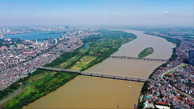
The area is included in the Red River urban zoning planning project
In this zoning plan, Hanoi has studied the planning of 8 Red River banks. In which, 6 new areas are studied and built at the rate of 5% (about 1,590 ha) including: Thuong Cat – Lien Mac, Hoang Mai – Thanh Tri, Chu Phan – Trang Viet, Dong Du – Bat Trang, Kim Lan – Van Duc. Particularly, the area of Tam Xa – Xuan Canh is researched and built at the rate of 15% (about 408ha). These riverbanks are proposed to build modern urban functional areas, synchronous in terms of social and technical infrastructure, with low construction density in line with the orientation of a typical spatial axis of green trees. water surface, the dominant landscape of the central urban area.
Regarding traffic in the planning area, for roads, two new urban trunk routes will be built along the Red River. Specifically, the Hong right bank axis from Hong Ha bridge to Thanh Tri bridge is planned with a cross-sectional scale with at least 4 motorized lanes and 2-4 mixed lanes. Hong left bank axis from Thuong Cat Bridge – Ta Hong dike – Vinh Tuy bridge – Thanh Tri bridge is planned with a cross-sectional scale of 40 – 60m wide (6 – 10 lanes).
The dyke lines passing through the inner city (Au Co, Nghi Tam, Yen Phu, Tran Nhat Duat, Tran Quang Khai, Tran Khanh Du, Nguyen Khoai streets) grade are inter-regional roads with size of 4 – 10 lanes. Other major urban and inter-regional roads have a width of 40 – 50m (6 – 8 lanes).
The main roads in the area are built on the basis of upgrading existing dike sections such as left Hong dike, right red dike Lien Mac – Thuong Cat section, section south of Thanh Tri bridge is determined to have 4-6 lanes. vehicles (including the road to collect the dike foot).
In particular, the project identifies and builds 6 new road bridges across the Red River, including Hong Ha Bridge and Me So Bridge on Ring Road 4 (size of 6 expressway lanes, 2 mixed lanes); Thuong Cat bridge and Ngoc Hoi bridge on ring road 3.5 (scale of 6 motorized lanes and 2 mixed lanes); Tu Lien bridge connects the urban trunk roads along the corridors on both sides of the Red River (scale of 6 motorized lanes and 2 mixed lanes); Tran Hung Dao bridge connects Tran Hung Dao street to Long Bien district area (scale of 6 motorized lanes and 2 mixed lanes).
at Blogtuan.info – Source: 24h.com.vn – Read the original article here


 5")