The East Sea may receive 2 storms and tropical depression in the next week
From April 7-8, a tropical depression is likely to appear over the southern waters of the East Sea and two storms in the east of the Philippines entering the East Sea.
The Standing Office of the National Steering Committee for Natural Disaster Prevention and Control has just said that, according to reference information from international forecasting agencies (Windy, Ventusky, …), around April 7-8, there is a possibility of There is a possibility of occurrence of 1 tropical depression (T-T) over the southern waters of the East Sea and 2 storms to the east of the Philippines that are likely to enter the East Sea.
 |
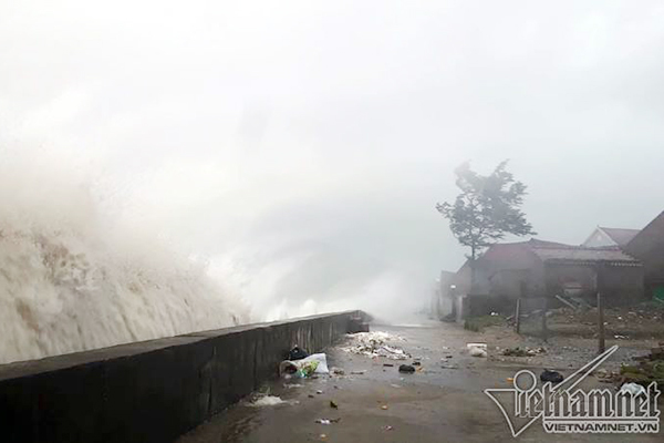
| The East Sea may receive 2 consecutive storms and 1 tropical depression in the next week. Photo: VNN |
This is an unusual situation, where tropical depression and storms may appear earlier than the annual rule.
In order to proactively respond to and minimize damage caused by possible tropical cyclones and hurricanes, and avoid subjective psychology, the Standing Office of the National Steering Committee for Natural Disaster Prevention and Control proposed the Steering Committees for Disaster Prevention and Control of provinces and cities. The city actively follows the forecast and warning information of domestic and international forecasting agencies about the development of tropical cyclones and storms that may appear in the near future.
Agencies notify captains, owners of means and ships operating at sea to proactively prevent and have appropriate production plans, ensuring safety of people and property; maintain contact information to promptly handle bad situations that may occur.
According to the Standing Office of the National Steering Committee for Natural Disaster Prevention and Control, in recent days, in the central region, there have been unusual and unseasonal rains (total common rainfall is 200-500 mm, in some places up to 500 mm). over 750 mm) accompanied by thunderstorms, large waves caused damage to people, houses, agricultural production and fisheries.
According to the National Center for Hydrometeorological Forecasting, from the night of April 3-6, the area from Thua Thien Hue to Khanh Hoa and the East Central Highlands continued to have heavy to very heavy rain; On the rivers from Thua Thien Hue to Khanh Hoa, there is a possibility of a flood with the flood peak reaching BD1 and above BD1. Risk of flash floods, landslides in mountainous areas and flooding in low-lying areas, riverside, urban areas.
In order to proactively respond to and minimize damage, the Standing Office of the National Steering Committee for Natural Disaster Prevention and Control proposed that the Steering Committees of Disaster Prevention and Control and Prevention and Control of provinces and cities focus on overcoming the consequences of natural disasters in the region. Central.
In addition, continue to closely monitor natural disasters, direct and deploy timely response measures to minimize damage, focusing on timely information for authorities and authorities at all levels. People actively prevent and minimize damage.
Deploying shock forces to inspect and review residential areas along rivers, streams, low-lying areas with high risk of floods, flash floods, landslides to proactively organize relocation and evacuation people when the situation occurs.
Review and be ready to arrange forces to control and guide traffic in flooded and divided areas; forces, materials and means to overcome incidents, ensure smooth traffic on the main traffic axes when rain or flood occurs…
Huong Quynh
at Blogtuan.info – Source: vietnamnet.vn – Read the original article here


